
Overview
A leader in augmented reality mapping systems approached Sealevel to help develop their next generation system and geospatial video recorder. The COM Express-based systems display and record video overlaid with mission critical information that is used by law enforcement, search & rescue, firefighters, military, unmanned aircraft systems (UAS), news gathering and more. For example, in airborne news gathering applications, the system displays and records live video of ground-based targets and overlays street names and points of interest in real time.
Key Design Challenge
The design required a very small footprint combined with high-performance specifications, extremely dense I/O features and wide operating temperature range.
The Sealevel Solution
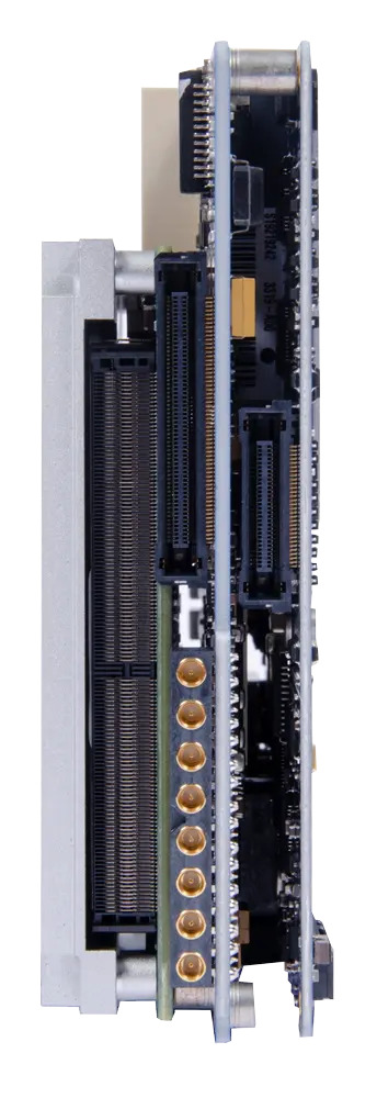
Sealevel’s engineering team created a dual-board carrier solution packed with an incredible amount of I/O in a very small form factor. The COM Express Type 6 carrier board is designed for a -40C° to +85°C operating temperature range and features a wide I/O set including
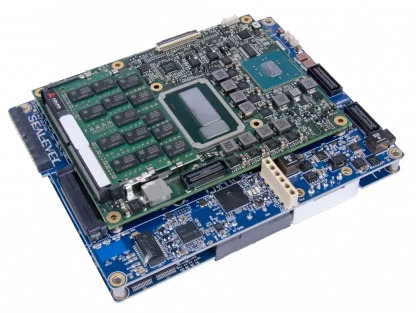
- (4)ARINC 429
- (2) Gigabit Ethernet
- (4) USB 3.0
- (8) A/D
- (1) D/A
- (20) GPIO
- (4) Differential audio
- (10) Serial
- (4) PS/2
- (1) CAN bus interfaces
- HDMIS, SDI, component and composite interfaces
- Dual M.2 expansion